FIRST SATELLITE PICTURES OF RUSSIA -UKRAINE WAR
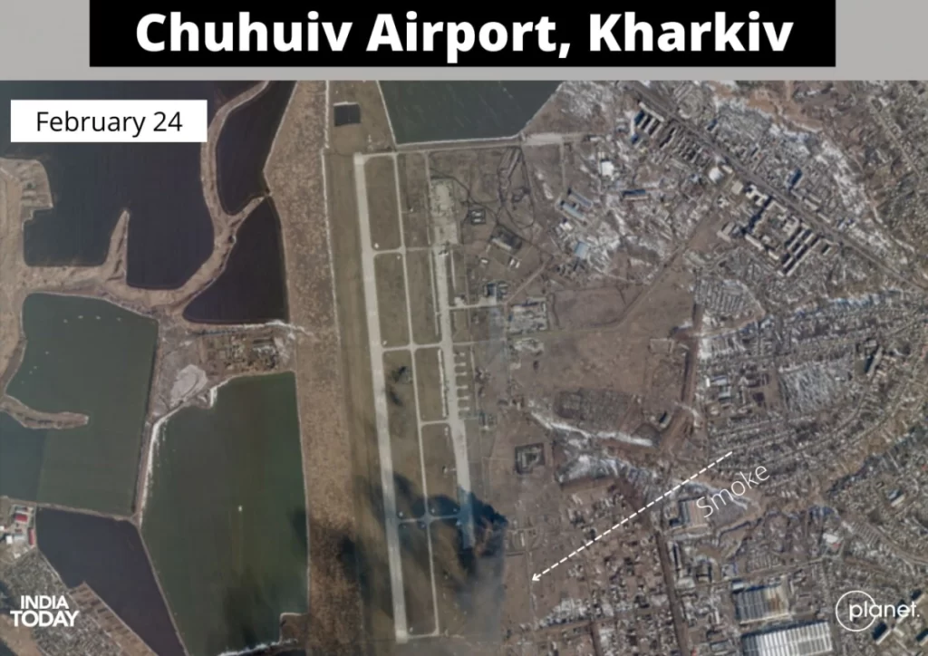
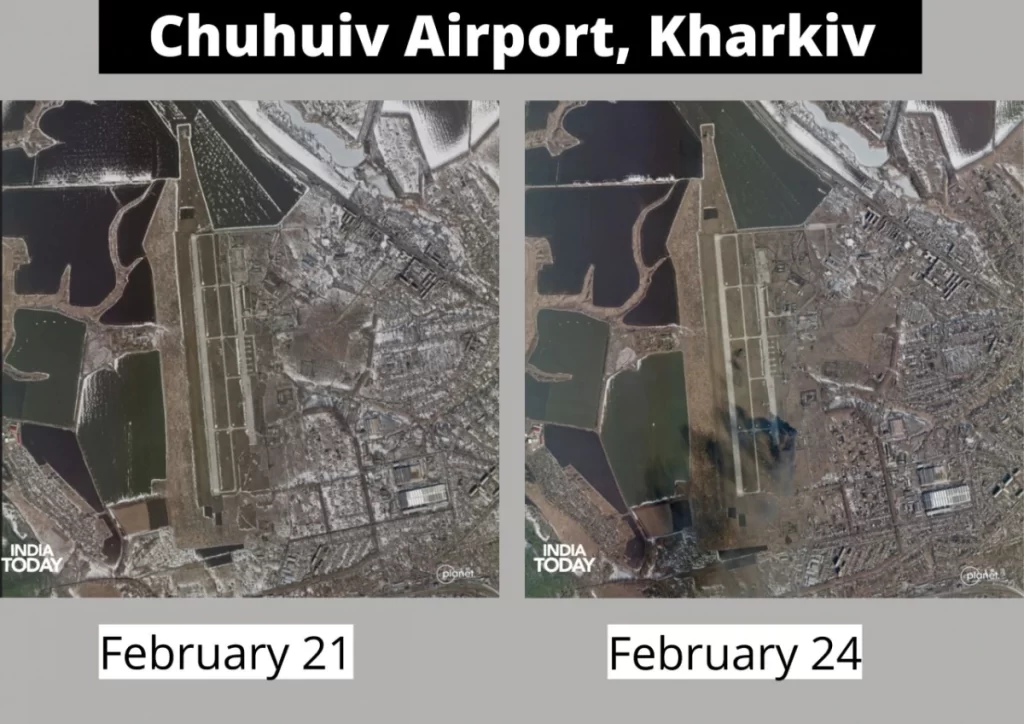
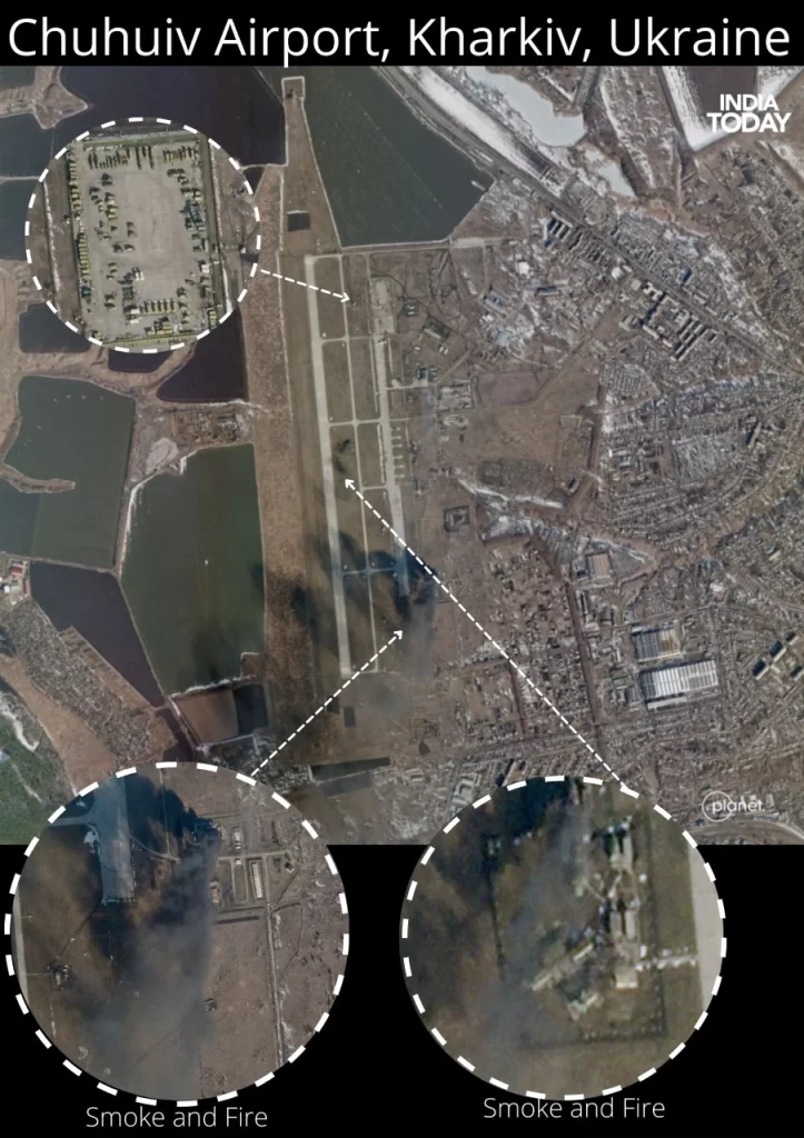
(The Quiver) : How devastating is the scenario of Russia- Ukraine war can be estimated by looking over the first set of satellites pictures after Russia invaded Ukraine. Satellite pictures provided by Space Company Planet Labs PBC showed a large plume of smoke near the runway. The radar and possible air-defense systems seem to have been completely annihilated by the early morning Russian air attack. The first set of satellites images starts from civilian apartments near airports hit during the airstrikes.
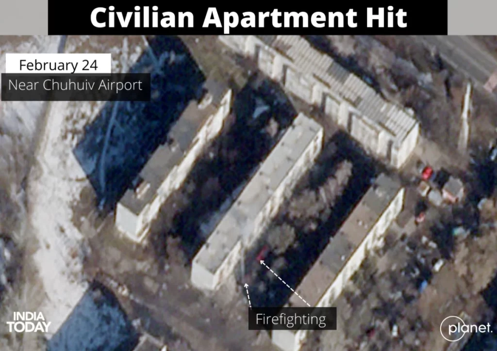
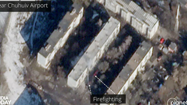
Several civilians were reportedly injured during the incident.The satellite imagery collected only hours after the attack provide a visual confirmation of this incident as fire truck deployed to control the fire is seen near the apartment in the pictures.
Soon after the strikes, several social media videos claimed that civilian apartments were hit near the airport during Russian airstrikes on Thursday.
Soon after the strikes, several social media videos claimed that civilian apartments were hit near the airport during Russian airstrikes on Thursday.